Altostratus
Altostratus is a uniform greyish or bluish sheet covering the whole sky at mid level. The sun shows through it as a dim, watery disc with no sharp edge, and objects on the ground stop casting shadows.
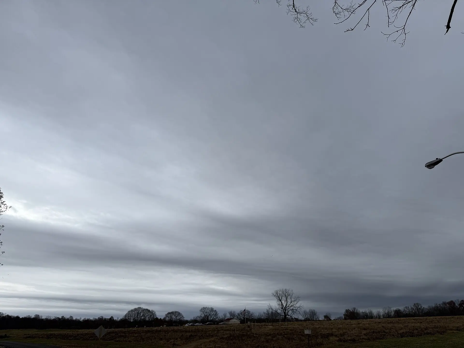
Photo: Famartin / CC BY-SA 4.0 · Wikimedia Commons
- Typical altitude
- 2,000–7,000 m (6,500–23,000 ft)
- WMO abbreviation
- As
- Altitude band
- Middle clouds
- Also called
- the boring cloud
How to recognise it
- A featureless grey or blue-grey sheet with no rolls, gaps or texture worth speaking of.
- The sun appears as if seen through frosted glass — visible as a pale patch, but with a blurred edge.
- No shadows on the ground. This is the quickest field test and separates it immediately from cirrostratus.
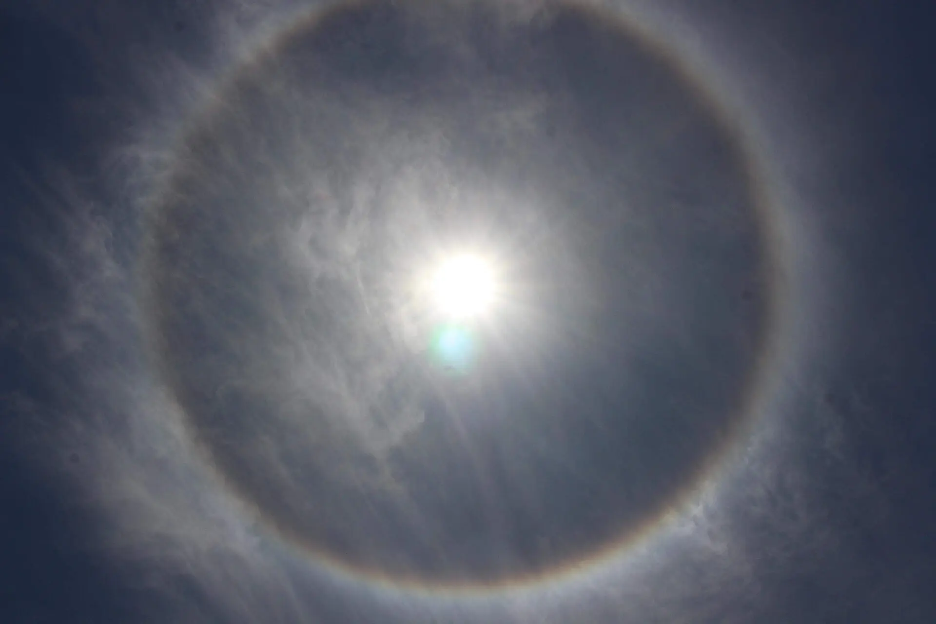
- Never produces a halo. If you can see a halo ring, you are looking at cirrostratus instead.
What weather it signals
- Altostratus is the middle stage of an approaching warm front, arriving after cirrostratus and before nimbostratus.
- Steady, prolonged rain or snow usually follows within a few hours as the sheet thickens and lowers.
- It can produce light precipitation itself, but it often evaporates before reaching the ground as virga.
How to photograph it
- Give the frame a strong foreground. The cloud has no internal structure, so the picture has to be carried by what is beneath it.
- Shoot in black and white or expect muted colour — the light under altostratus is flat and grey by nature.
- Include the dim solar disc if it is visible; it is the single most identifiable feature of this cloud.
Fun facts
- Altostratus is widely called the most boring cloud in the sky — the WMO cloud atlas itself notes it has no distinguishing features and no species.
- It is the only genus with no species classification at all, precisely because it is so uniform.
- It often forms when cirrostratus thickens and descends, so the same air mass can pass through three genera in a single afternoon.
Easily confused with

Frequently asked questions
How do I tell altostratus from cirrostratus?
Check for a shadow. Under cirrostratus the sun still casts a clear shadow and can produce a halo. Under altostratus the sun is dimmed to a featureless watery patch, shadows vanish, and there is no halo.
Does altostratus mean rain?
Usually, yes. It is the second stage of a warm front sequence. As it thickens and lowers into nimbostratus, steady rain or snow typically begins within a few hours.
Why does the sun look watery through altostratus?
The sheet is thick enough to scatter most of the direct light but not thick enough to block it entirely, so the solar disc is still there but has lost its sharp edge — the same effect as looking at a lamp through frosted glass.
Not sure what you are looking at?
Point your iPhone at the sky and let Cloud ID name it for you — with three ranked candidates and the reasoning behind each one.
Download on the App Store